
AI platform for upscaling images, enhancing photos, and generating high-quality creative assets with contextual detail.

GeoImageTagger
$10Starting price
3.2KMonthly visits
8Popularity
About GeoImageTagger
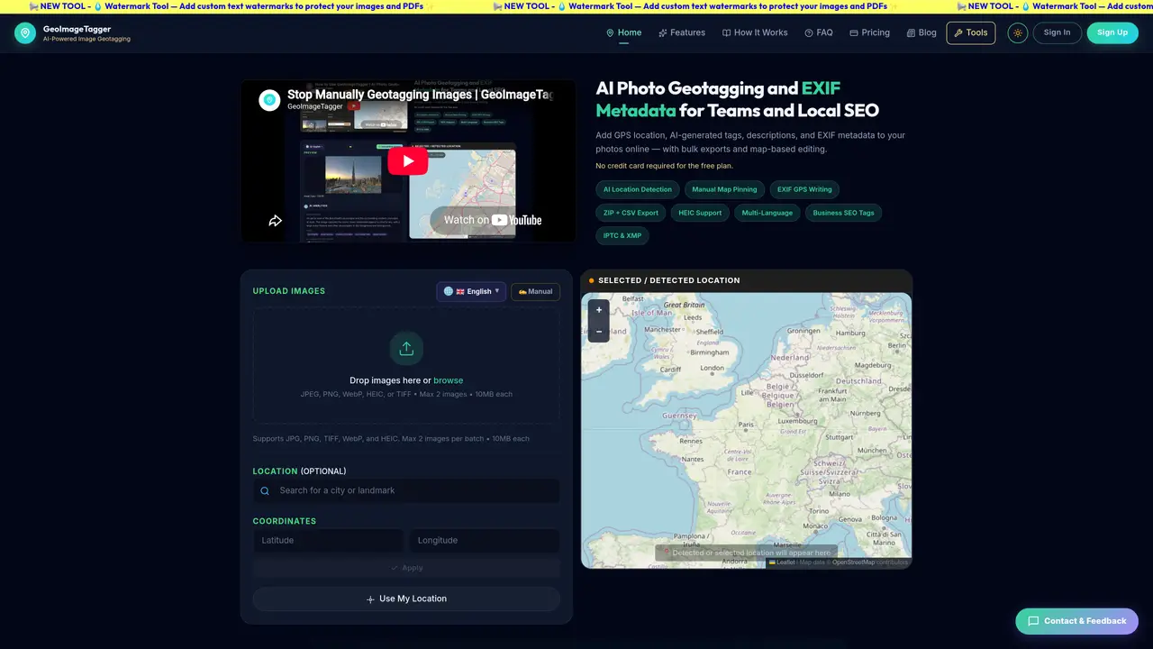
GeoImageTagger is an online service designed to analyze images and extract location data, generate descriptive tags, and embed GPS coordinates and EXIF metadata directly into image files. The tool supports a wide range of image formats, including JPEG, PNG, TIFF, WebP, and HEIC, making it versatile for various types of digital content. Users can process images in batches, with the free plan allowing up to two images per batch and paid plans supporting larger batches of up to ten images. GeoImageTagger offers two distinct modes: AI mode, which automatically detects locations and generates SEO-ready tags and descriptions in multiple languages, and manual mode, which provides users with full control to set all metadata fields themselves. Before finalizing the process, users can review and edit the metadata to ensure accuracy and completeness. Once processed, images can be downloaded individually, as a ZIP bundle that includes JSON metadata, or as a CSV summary for easy integration into workflows. The service writes metadata into EXIF, IPTC, and XMP fields using ExifTool, ensuring compatibility with search engines and content management systems. This makes GeoImageTagger particularly useful for photographers, content creators, and businesses looking to enhance the discoverability and organization of their image libraries.
Key features
- AI location detection
- Manual map pinning and coordinate entry
- EXIF, IPTC, and XMP metadata writing
- SEO-optimized tag and description generation
- Multi-language support (8+ languages)
- Business-specific SEO tagging
- Bulk ZIP and CSV export
- Interactive map with autocomplete
Use cases
- Local SEO teams geotagging storefront and landmark photos
- Field inspections documenting job sites with GPS-tagged photos
- Agencies managing location-rich photo libraries for clients
Pros
- AI-powered location detection from images
- Supports multiple image formats including HEIC
- Multi-language metadata generation
- Bulk export options (ZIP, CSV, JSON)
- Manual editing and control over metadata
Cons
- Limited to 2 images per batch on free plan
- No API access mentioned
- Requires account for processing and downloads
GeoImageTagger videos
Frequently asked questions about GeoImageTagger
What is GeoImageTagger?
GeoImageTagger is an AI-powered online tool that detects locations in images, generates relevant tags and descriptions, and embeds GPS coordinates and EXIF metadata directly into image files.
Do I need an account to use GeoImageTagger?
You can upload and preview images without an account, but processing images and downloading results requires a free account. Sign-up is quick and does not require a credit card.
What image formats are supported by GeoImageTagger?
GeoImageTagger supports JPEG, PNG, TIFF, WebP, and HEIC formats. The tool preserves the original format when possible and only converts when necessary for metadata embedding.
How accurate is the AI location detection in GeoImageTagger?
Accuracy depends on visible landmarks, text, signage, architecture, or other distinctive features in the images. If the AI cannot detect a location, users can set it manually using search, coordinates, or the map.
What languages are supported for tag and description generation?
GeoImageTagger supports multi-language generation including English, French, German, Spanish, and several others. Additional languages like Arabic and Turkish are coming soon.
What is Manual Mode in GeoImageTagger?
Manual Mode allows users to write their own descriptions, tags, and set locations without using AI, providing full control over the metadata for each image.
GeoImageTagger Website Engagement
Last Update: 9 days ago
Total Monthly Visits
0
Bounce Rate
0%
Visit Duration (avg)
—
Pages Per Visit
0
Country Rank
0
United Kingdom
Global Rank
0