AI assistant for safe, reliable productivity with code, collaboration, and integrations.

LandLens
£9.99Starting price
820Monthly visits
0Popularity
About LandLens
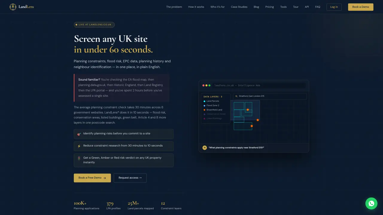
LandLens aggregates official UK government planning and land-use data into a single interface, enabling users to screen sites for constraints such as flood risk, conservation areas, listed buildings, green belt and brownfield status. The platform combines Ordnance Survey mapping with live data from HM Land Registry, planning.data.gov.uk, Environment Agency and Historic England, updated in real time. Users can query the system in plain English to find development opportunities or assess specific sites, receiving results overlaid on official OS maps with risk verdicts and policy summaries. The tool is designed for planning professionals, developers, brokers and investors who need to reduce manual research time from hours to seconds. It supports both one-off searches and ongoing monitoring, with branded reports and exportable data for client presentations. The platform also addresses gaps in public records by tracing constraints that may be missing from national portals due to council mergers or decommissioned websites.
Key features
- AI-powered plain-English site discovery
- 12 live constraint layers including flood zones and green belt
- Site Verdicts™ risk scoring
- NeighbourID™ for boundary ownership lookup
- Branded PDF and Excel exports
- Real-time government data integration
- Site monitoring and email alerts
- Ordnance Survey Premium mapping
Use cases
- Rapid assessment of planning constraints for property purchases
- Finding brownfield or stalled development sites by opportunity
- Identifying neighbour ownership for pre-application outreach
Pros
- Aggregates 12 live constraint layers from official UK sources
- Plain-English AI queries replace manual searches across multiple portals
- Real-time updates from government APIs
- Includes risk verdicts and ownership identification
- Offers both one-off and subscription pricing models
Cons
- No free tier beyond a 5-day trial
- Single-site reports require manual review and email delivery
- Limited to UK planning data
- Subscription plans restrict usage to one seat per account
Frequently asked questions about LandLens
What is LandLens and what does it do?
LandLens is a UK planning intelligence platform that aggregates official government planning and land-use data into a single interface. It enables users to screen sites for constraints such as flood risk, conservation areas, and listed buildings using real-time data from sources like the Environment Agency, Historic England, and HM Land Registry.
Who is LandLens designed for?
The platform is designed for planning professionals, developers, brokers, and investors who need to assess sites quickly and reduce manual research time. It supports both one-off searches and ongoing monitoring with branded reports and exportable data.
How does LandLens work?
Users can query the system in plain English to find development opportunities or assess specific sites. The tool combines Ordnance Survey mapping with live data from multiple government sources, providing results overlaid on official maps with risk verdicts and policy summaries.
Can LandLens identify constraints that are missing from public records?
Yes, LandLens goes beyond standard database lookups by tracing constraints that may be missing from national portals due to council mergers or decommissioned websites. It uncovers enforceable restrictions that are not always visible in public records.
Does LandLens offer a free trial or demo?
LandLens offers a free 5-day trial for users who want to try the platform. Additionally, prospective users can book a demo to explore its features before committing to a subscription.
What data sources does LandLens use?
The platform sources data directly from official UK government APIs, including Ordnance Survey, HM Land Registry, planning.data.gov.uk, Environment Agency, and Historic England. All data is updated in real time.
LandLens Website Engagement
Last Update: 9 days ago
Total Monthly Visits
0
Bounce Rate
0%
Visit Duration (avg)
—
Pages Per Visit
0
Country Rank
—
Unknown
Global Rank
—